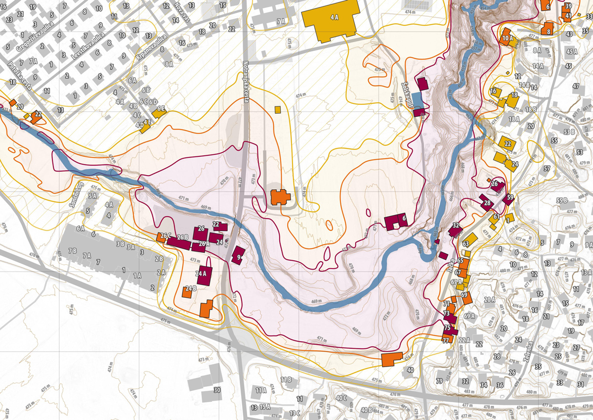
Detailed mapping of cycling routes

a method for digital mapping of cycling routes on a detailed Digital Elevation Model (DEM)

The market offers many products, applications to track and visualise cycling routes. Presented methods are an extension of available products, developed to improve data attributes, most of all, the accuracy of data.

Flood risk assesment for buildings in Slovenia

intersection of two official datasets and cartographic presentation of results

Slovenian Water Agency (within Ministry of the Environment and Spatial Planning) produced Maps of Flood Risks, the task was to intersect the Maps of Classes of Flood Risks with the Building Cadastre (produced by Surveying and Mapping Authority of the Republic of Slovenia). This identified the buildings that are at risk of flooding. The results are presented in an Interactive map for the territory of Slovenia, for simple access and data visualisation. For civil protection and disaster relief planning in case of a flood, a topographic printable map templates were developed.

3D object vizualisation on a diverse terrain

A method for rapid 3D object visualistion on a diverse terrain. Practical example of reconstructed archeological remains.

In the digital age we have a range of different software solutions, tools and workflows available for the spatial visualisation of planetary surfaces, objects and architecture. In this sea of programs and file standards we are often faced with the challenge of combining different 3D models. This article introduces a method for rapid and simple visualisation of objects, basic architectural elements, on very diverse terrain. Practical implementation of a late-roman fort AD PIRVM on Hrušica mountain pass.

Wine regions of Slovenia

Interactive map of Slovenian wine regions, web application

On the basis of the Land use registry of Ministry of Agriculture, Forestry and Food, and Uradni list (Official Journal), a legal act describing areas for wine labelling, I prepared a map of Slovenian wine regions and areas. A database has been added to serve as a tool for the self-presentation of small vineyard keepers and wine makers.

Prehistoric settlements

LIDAR Data interpretation, visualisation, educational GIS database design

The toponym gradišče is very common in Slovenia. It usually refers to an area where the remains of earlier settlements have been found. Archaeological investigations have discovered a rich and varied settlement dynamics in prehistory. Modern tools for visualisation offer new perspectives on the landscape. Presentation of some of the most interesting prehistoric settlements based on surface visualisations of LIDAR data.

Refugio’s - Late Antique fortified settlements

GIS database based on LIDAR data, field research and literature review. Thematic maps.

For the design of a main database for the production of thematic historical maps, I chose a scientifically well studied period of Late Antiquity. Interesting settlement pattern and a lot of literature made a perfect case study possible.

Abandoned tunnel Naklo in Logatec - urban renewal project

Proposal for development strategy, management and a simple traffic study

I have prepared this proposal in response to the request of the Logatec Municipality for suggestions and comments from the interested public on the issue of abandoned railway tunnel. I have tried to find a solution that will benefit most shareholders. In addition to the protection of the technical heritage, the consideration of the needs of residents and visitors, it aims to improve all other spatial qualities.